Crissy Field - From World's Fair to Airfield to Marsh
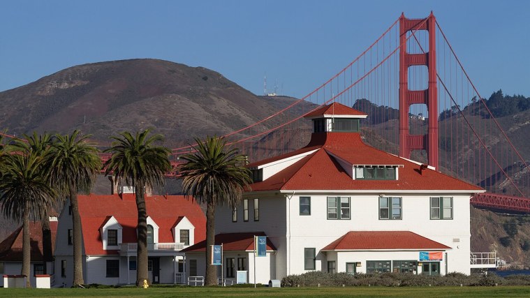
Photo: Frank Schulenburg, CC BY-SA 4.0 (cropped)
A stop on San Francisco, District by District, a free self-guided tour.
The long lawn by the water was once an airfield. In 1915 this shoreline was part of the grounds of the Panama-Pacific International Exposition, the world's fair that celebrated the Panama Canal and the city's recovery from 1906. The domed Palace of Fine Arts, just east of the park, is the fair's best-known survivor.
The Army opened Crissy Field in 1921, named for Major Dana Crissy, a pilot killed in a 1919 transcontinental flying contest, and pioneering flights came and went here through the 1920s. Fog and the coming Golden Gate Bridge limited its future, and the Army closed the field to airplanes in 1974. After the Army left, crews removed tons of debris and contaminated soil, and in 2001 Crissy Field reopened with restored dunes and a tidal marsh.
Walk the shoreline path west toward the bridge, about 30 minutes to Fort Point.
More on Wikipedia: Crissy Field · Panama-Pacific International Exposition · Palace of Fine Arts
Stops on this tour
- Ferry Building and the Embarcadero - Where the City Met the World
- Financial District and Jackson Square - Gold Rush on the Old Shoreline
- Chinatown - The Neighborhood That Refused to Move
- North Beach and Telegraph Hill - Little Italy and the Beats
- Fisherman's Wharf - Italian Boats and Old Ships
- Nob Hill and Russian Hill - Cable Cars, Mansions and the Great Fire
- The Presidio - Two Centuries Guarding the Golden Gate
- Japantown and the Fillmore - Two Communities, One Neighborhood
- Haight-Ashbury - From Victorian Suburb to Summer of Love
- Golden Gate Park - Sand Dunes Turned Into a Park
- The Castro - A Neighborhood That Became a Movement
- The Mission - Where San Francisco Began
- Civic Center - Domes, Charters and Protest
- South of Market - From Rincon Hill to the Tech Boom