James Kipp Recreation Area - The Missouri Breaks
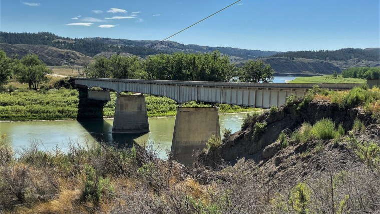
Photo: Jon Roanhaus, CC BY-SA 4.0 (cropped)
A stop on American Prairie: Rewilding the Plains, a free self-guided tour.
Here US 191 crosses the Missouri River on the Fred Robinson Bridge, built in 1959 and named for the state senator who fought for it. You are standing near the lower end of the Upper Missouri River Breaks National Monument, created in 2001 to protect about 377,000 acres of federal land along 149 miles of the river.
Look at the bluffs. The breaks are badlands carved as the river and its side streams cut down through soft sandstone and shale, leaving coulees, ridges and cliffs. Congress named this stretch of the Missouri a Wild and Scenic River in 1976, and much of it looks as it did when the Lewis and Clark Expedition worked its boats upstream through it in 1805.
The Bureau of Land Management's James Kipp Recreation Area has a campground, boat ramp and vault toilets, and many float trips on the monument end here. Walk down to the water, watch the current, and remember that for thousands of years this river was the main road across the plains.
Getting here: Drive south on US 191 about eight miles, cross the Fred Robinson Bridge over the Missouri, and turn into the recreation area entrance just south of the river.
Did you know?: The Fred Robinson Bridge joined the National Register of Historic Places in 2012, and its nomination calls it the best documented bridge in Montana - its construction was controversial in its day.
Photo op: From the boat ramp, frame the bridge spans with the river and the eroded breaks rising behind them, best in low evening light.
More on Wikipedia: Upper Missouri River Breaks National Monument · Fred Robinson Bridge · Lewis and Clark Expedition
Stops on this tour
- Phillips County Museum - Elvis and the Homesteaders
- Great Plains Dinosaur Museum - Leonardo's Hometown
- Bowdoin National Wildlife Refuge - Pelicans on the Plains
- Sun Prairie - Back in Bison Country
- Buffalo Camp - Where the Argument Lives
- Mars Vista - Prairie Dogs and the Paved Way In
- James Kipp Recreation Area - The Missouri Breaks
- Slippery Ann - Elk on the Russell Refuge
- Zortman - Gold in the Little Rockies
- Fort Belknap Agency - The Herds Came Home Here First