Park Point - Top of the Green Table
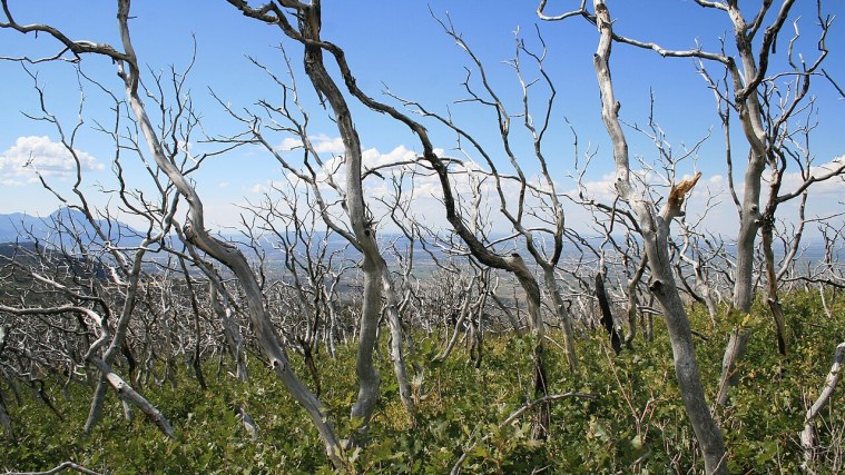
Photo: Andreas F. Borchert, CC BY-SA 4.0 (cropped)
A stop on Mesa Verde Cliff Dwellings, a free self-guided tour.
Take the short paved path up to the fire lookout at 8,572 feet, the highest point in the park. On a clear day you can turn in a full circle and take in the Four Corners country: the La Plata Mountains to the northeast, Sleeping Ute Mountain to the west, and the long, flat Montezuma Valley below.
Notice which way the land slopes. Mesa Verde is not a flat table at all. It tilts gently south, and the canyons that slice it carry water toward the Mancos River. That tilt is a big part of why people could live here: south-facing slopes and alcoves soak up winter sun.
The gray snags around you tell a newer story. Large wildfires since the 1990s burned much of the pinyon and juniper forest, and surveys after the fires turned up hundreds of archaeological sites the trees had hidden.
The lookout is staffed as needed during fire season, so you may meet someone keeping watch.
Getting here: Drive about 10 winding miles up the main park road past Morefield Campground and turn into the Park Point parking area.
Did you know?: Geologists call Mesa Verde a cuesta rather than a true mesa, because the whole tableland tips toward the south instead of lying flat.
Photo op: From the lookout, shoot west toward Sleeping Ute Mountain in late afternoon light.
Nearby: Vault toilet and picnic tables near the parking area; no water or food.
More on Wikipedia: Fire lookout tower · Mesa Verde National Park · Ute Mountain
Stops on this tour
- Visitor and Research Center - Plan Your Mesa
- Park Point - Top of the Green Table
- Far View Sites - Village Life on the Mesa Top
- Step House - Two Villages, Six Centuries Apart
- Chapin Mesa Museum - Dioramas of Daily Life
- Spruce Tree House - Life in an Alcove
- Balcony House - The Adventure Tour
- Pithouses and Early Pueblos - Before the Cliffs
- Square Tower House - The Tallest Walls
- Sun Point View - A Canyon Full of Neighbors
- Oak Tree House and Fire Temple - Fewkes Canyon
- Sun Temple - A Building Without a Roof
- Cliff Palace - The Largest Cliff Dwelling