Harry Bridges Plaza - The Freeway That Fell
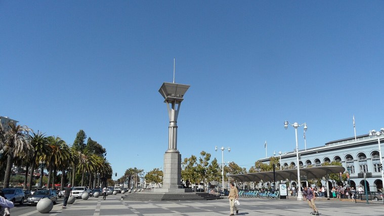
Photo: Gianluca Cogoli, CC BY 3.0 (cropped)
A stop on San Francisco, District by District, a free self-guided tour.
Stand in the plaza facing the clock tower. From 1959 until 1991 you could not have seen it from here: the double-deck Embarcadero Freeway ran right across this spot, its concrete decks blocking the view down Market Street. It was meant to be part of a much larger freeway network, but in 1959 residents in what became known as the freeway revolt persuaded the Board of Supervisors to cancel most of the planned routes, leaving this one dead-ending along the waterfront.
The Loma Prieta earthquake of October 17, 1989 damaged it, and after a heated debate the city chose to tear it down rather than repair it. The removal opened the way for the palm-lined boulevard, the F-line streetcars and the busy promenade you see now.
The plaza is named for Harry Bridges, the Australian-born longshoreman who led the 1934 strike and headed the West Coast dockworkers' union for decades.
More on Wikipedia: California State Route 480 · Harry Bridges · Highway revolt · 1989 Loma Prieta earthquake
Stops on this tour
- Ferry Building and the Embarcadero - Where the City Met the World
- Financial District and Jackson Square - Gold Rush on the Old Shoreline
- Chinatown - The Neighborhood That Refused to Move
- North Beach and Telegraph Hill - Little Italy and the Beats
- Fisherman's Wharf - Italian Boats and Old Ships
- Nob Hill and Russian Hill - Cable Cars, Mansions and the Great Fire
- The Presidio - Two Centuries Guarding the Golden Gate
- Japantown and the Fillmore - Two Communities, One Neighborhood
- Haight-Ashbury - From Victorian Suburb to Summer of Love
- Golden Gate Park - Sand Dunes Turned Into a Park
- The Castro - A Neighborhood That Became a Movement
- The Mission - Where San Francisco Began
- Civic Center - Domes, Charters and Protest
- South of Market - From Rincon Hill to the Tech Boom