Happy Isles - Where the Trails Begin
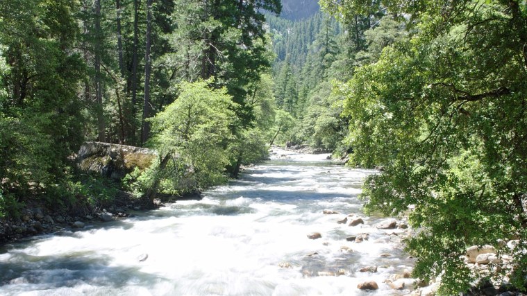
Photo: Emmanuel DYAN from Paris, France, CC BY 2.0 (cropped)
A stop on Yosemite Valley, a free self-guided tour.
The tour ends where the Merced River tumbles out of the high country onto the valley floor. Happy Isles is a cluster of small islands in the river, linked by footbridges, at the far eastern end of Yosemite Valley.
This is the gateway to the backcountry. The Mist Trail starts here, climbing past Vernal and Nevada Falls toward Half Dome, and so does the John Muir Trail, which runs more than 200 miles to Mount Whitney. It's named for the Scottish-born naturalist who first came to Yosemite in 1868 and spent his life fighting to protect it. His writing and campaigning helped create Yosemite National Park in 1890, and in 1906 the valley itself came back under federal control.
Look for the signs about July 10, 1996, when a huge slab of granite broke off the cliff near Glacier Point. The rockfall and its blast of air flattened about 1,000 trees and killed one person.
Wander the islands, but keep away from the fast water; the Merced here is cold and powerful.
Getting here: Walk back down to the Mirror Lake trailhead and ride the free shuttle to the Happy Isles stop, or follow the path along the river for about a mile.
Did you know?: In 1903 John Muir took President Theodore Roosevelt camping in Yosemite for three nights, a trip that helped win Roosevelt's support for returning the valley to federal care.
Photo op: From one of the footbridges, frame the Merced River rushing over boulders between the islands, with the forest behind.
Nearby: Restrooms near the trailhead. The Happy Isles Art and Nature Center opens seasonally; food and drinks are at Curry Village, a short walk or shuttle ride away.
More on Wikipedia: Happy Isles · John Muir Trail · Mist Trail · 1996 Yosemite Valley landslide
Stops on this tour
- Tunnel View - The Whole Valley at Once
- Bridalveil Fall - Spirit of the Puffing Wind
- El Capitan Meadow - Watch for Climbers
- Swinging Bridge - River Views of Yosemite Falls
- Yosemite Valley Chapel - Lincoln's Gift and a Moving Church
- Sentinel Bridge and Cook's Meadow - Half Dome in the River
- Lower Yosemite Fall - Where Muir Made His Home
- Yosemite Village - The People of Ahwahnee
- The Ahwahnee - A Grand Hotel in Disguise
- Mirror Lake - A Lake Turning into Meadow
- Happy Isles - Where the Trails Begin